
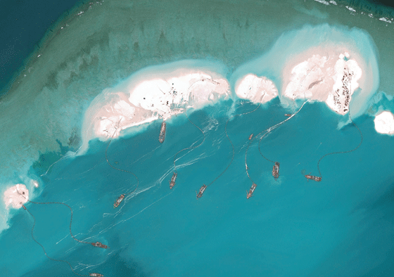
This handout photo taken on March 17, 2015 by satellite imagery provider DigitalGlobe and released to AFP by the Asia Maritime Transparency Initiative department at the Center for Strategic and International Studies (CSSI) think tank shows a satellite image of vessels purportedly dredging sand at Mischief Reef in the Spratly Islands in the disputed West Philippine Sea. The series of satellite images posted on the website of the Center for Strategic and International Studies show a flotilla of Chinese vessels dredging sand onto Mischief Reef and the resulting land spreading in size. Beijing on April 9 reaffirmed its right to build on the disputed islands after the satellite imagery emerged of construction operations turning tropical reefs into concrete artificial islands. The Philippines, Vietnam, Malaysia, Brunei and Taiwan all have overlapping claims in the area. AFP PHOTO